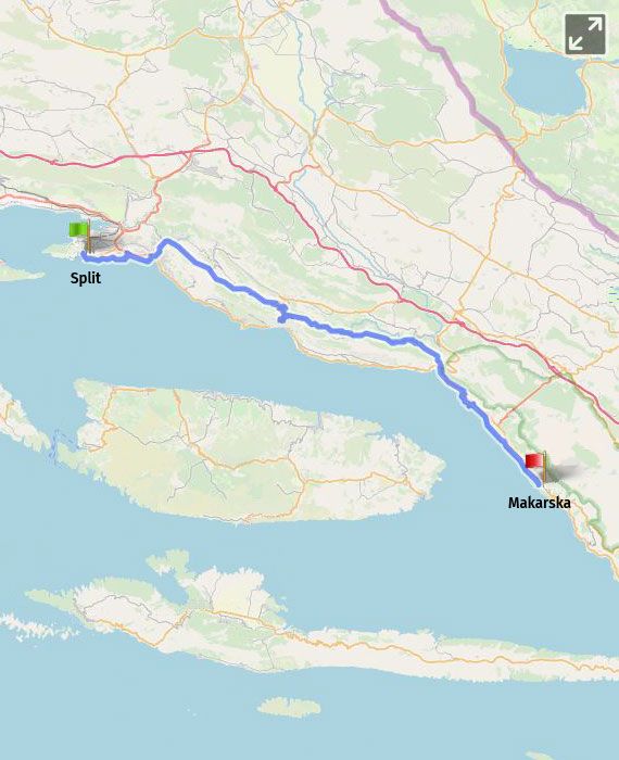
Split – Žrnovnica (13 km) – Omiš (31 km) – Brela (61 km) – Makarska (74 km) |
|
distance 74.00 km |
|
start Split |
|
end Makarska |
|
total climb 980.00 m |
|
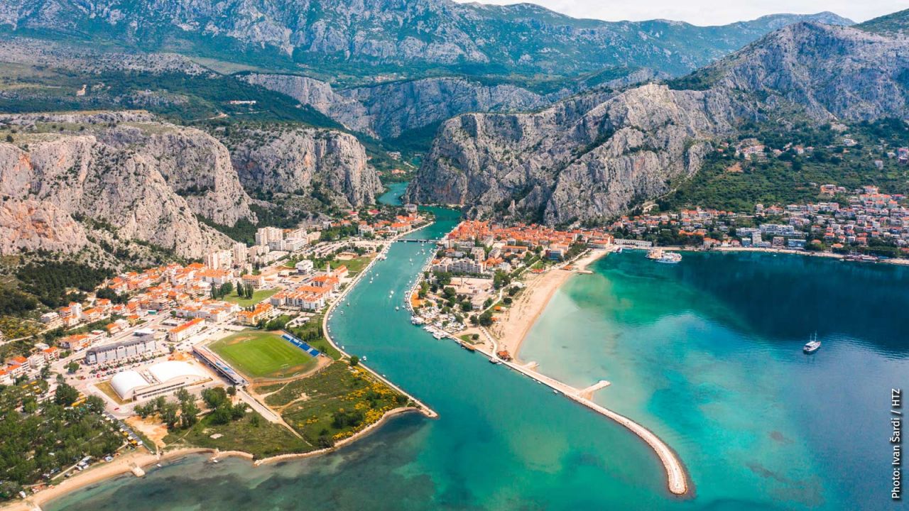
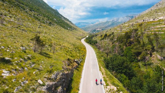
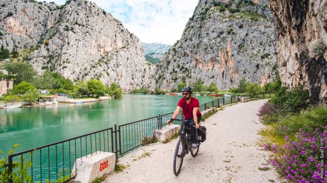
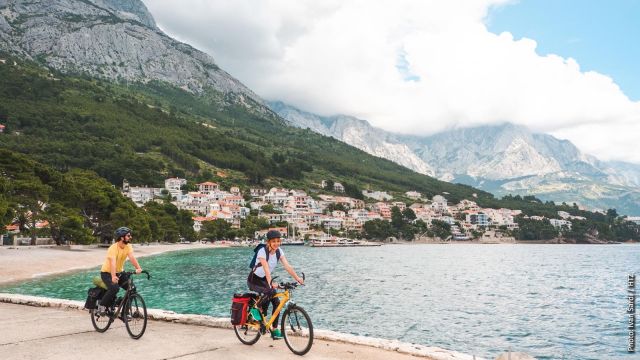
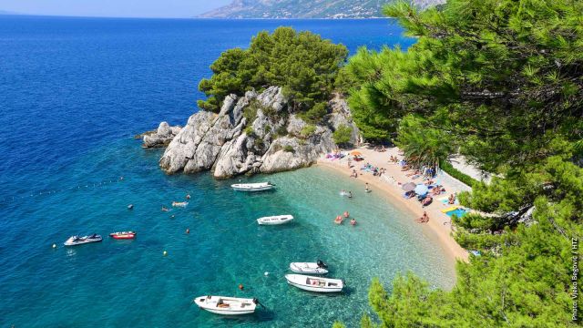
The route leads from Split following the coastline past the Railway Station and the Port of Split, then along the beach Bačvice and the sports Port Zenta in Firule, along the roads and beaches of the city district Žnjan towards Stobreč. It leads past the Stobreč waterfront, the Stobreč Campsite, then it turns towards Omiš, following the course of the River Žrnovnica. Stobreč is idyllically located at the very mouth of the River Žrnovnica into the Adriatic Sea. Since the route follows the flow of the river, it provides a beautiful view of the mountain Mosor (1339 m), at the foot of which the River Žrnovnica springs, and the view of somewhat lower Poljička gora. There is an observatory (702 MAMSL) in the village of Gornje Sitno (22 km from Split). The view is captured by the terraced, cultivated fields of grape vines, olive trees and various fruits, which are traditionally cultivated in the area of Poljica nowadays, from Žrnovnica via Srinjine towards Tugare, where the route passes through. After Tugare, the route leads towards Omiš, taking a winding road downhill towards the River Cetina. The ride downhill onto D70 road offers the view of the impressive canyon of the river. Reaching Omiš, the route leads over Omiš Bridge on the Cetina and continues towards Kučiće along a local road and the southern bank of the Cetina Canyon, below high, almost vertical reefs of Omiška Dinara (863 m), with occasional tunnels built through it. A winding climb along the road leads to Kučiće and Vukosavić, followed by another winding descent towards the Cetina. The route continues climbing towards Slime (3 km). The view from Slime to Zadvarje and the surrounding fields is striking. The place Slime is dominated by the parish church of St. John the Baptist from 1780 and it is also the birthplace of the famous Croatian writer Josip Pupačić. D39 road takes a winding descent and exits onto D8 and continues towards Brela and Baška Voda. Brela beaches are listed among the most beautiful beaches in the world, and the view of the mountain Biokovo (1762 m), with its almost vertical plunge into the Adriatic Sea is one of the most striking features of the Makarska Riviera, just like the Kamen Brela – a rock in the sea adorned by pine trees, which is a recognizable symbol of the place. Along the picturesque Makarska Riviera full of lush vegetation through Baška Voda, Baško Polje, Promajna, Bratuš and Krvavica, the route reaches the town of Makarska.
|
|
km |
Description |
|
Length of the section |
|
74 km |
|
Proportion of asphalt/macadam |
|
95/5% |
|
Total climb |
|
980 m |
|
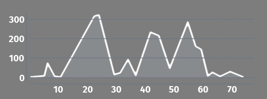
Higher climbs |
9-24 38-42 49-54 |
320 m, 2.5% on average 220 m, 5% on average 230 m, 5% on average |
|
Macadam lining – well rideable |
9 |
Between Stobreč and Žrnovnica 1.2 km |
|
Macadam lining – moderately and badly driven |
70 |
Before Makarska - 1.8 km (from the campsite) |
|
Traffic density – moderate |
2 8 11 |
Exit from Split – 1.2 km From Stobreč to D8 – 800 m From Žrnovnica to Srinjine – 6 km |
|
Traffic density – high |
56 |
D8 before entering Brela – 3.5 km |
|
Occasional bike pushing needed |
13
66 68 70 |
The junction from the stream Žrnovnica to the road – 20 m Baško Polje: bike traffic ban – 150 m
Promajna – bypassing 10 stairs – 20 m Narrow pedestrian path, 700m of bike pushing; possible bypass (see below) |
|
Stairs |
66 |
Baško Polje: 3 stairs + 7 more |
|
Obstacles |
66 |
Baško Polje – a narrow passage (the post in the middle) |
|
Supply options |
37 43 51 |
Lots of well supplied small towns, Less frequent from Omiš to Brela (31st – 61st km) A restaurant near the Cetina Kučiće: a shop, restaurants, potable water Slime: a shop |
|
Water sources |
41 |
Along the road at the rest area |
|
Rest options |
8 16 23 31
32 41 |
Beaches: Stobreč, Omiš and further from Brela to Makarska Stobreč, near the church: benches in the shade above the beach On ŽC6142 before Srinjin: benches and a table Tugare: benches in the shade, water A park in Omiš: benches in the shade Benches and a table along the road and the River Cetina Roadside rest area, stone benches, a water source |
|
Accommodation options |
|
In less populated area in private rooms and apartments, hotels and campsites |
|
Bicycle repair service |
31 74 |
Omiš Makarska |
|
Ship |
74 |
Makarska |
|
Alternatives |
|
The alternative section A8 takes the ferry to the island of Korčula and connects to the main route on Pelješac, on the main section 18 |
|
Bypass options |
70 |
Bypass of the pedestrian path near Krvavica includes a 3km on busier D8 and a 100-m climb |
|
km |
Technical description of the section |
|
0 |
The route follows the coast for 5 km, taking the less busy roads of the city districts Bačvice, Firule, Žnjan and along beaches. |
|
5 |
At the end of Put Žnjana Street, the route leaves the coast and continues to the left into Put Dujlova Street. |
|
6 |
200 m before D8, it turns to the right from Put Dujlova Street and follows Put Orišca and Ivankovca Street towards Stobreč (2.5 km). |
|
8 |
In Stobreč, at the Y intersection near the parish church, turn to the left. The road passes through the centre of Stobreč and leads onto D8. |
|
9 |
Having crossed D8, it immediately turns to the right onto a macadam road parallel to D8. After 300 m, it turns to the left onto the macadam pedestrian-cycling path along the River Žrnovnica. |
|
11 |
After 1.5 km, the path leads to Poljička cesta, continuing towards Srinjine. The road turns to the right, enters Žrnovnica and continues as ŽC6142 through Srinjine and Tugare. |
|
25 |
Then 2.5 km after the centre of Tugare at the intersection, the route turns to the right towards Omiš. 1.5 km from that place at the next intersection, it turns to the right again towards Omiš. The route descends through the impressive landscape of the River Cetina Canyon. |
|
30 |
The route enters Omiš and turns to the left over the bridge (200 m on D8) and turns to the left again onto ŽC6166 along the Cetina. The centre of Omiš is perfect for rest and replenishment before the climb and quite long area with reduced supply options. |
|
49 |
The route slightly climbs along ŽC6166, passing through Kučiće, descending towards the Cetina again, and at the intersection after the downhill, it turns to the right, following the signposts for Slime and Makarska (23 km). |
|
55 |
The road exits onto D39 and continues to the right on it, then after 1 km, D39 exits onto busy D8, and the route continues to the left, taking 3.5 km to reach Brela. |
|
59 |
Near the restaurant Šampioni Brela turn to the right, and downhill to the coast going through the streets: Stjepana Radića, Banje and Podraće. The route leads by the sea past the attraction the Brela Rock taking a pedestrian-bicycle path for 1 km until reaching the road. |
|
62 |
The route leads to the left past the hotel and reaches Frankopanska Street, and along it to the right towards Baška Voda and further along the coast through Baško Polje, Promajna, Bratuš and Krvavica, taking mostly pedestrian-bicycle paths, where bike should be occasionally pushed or a few stairs taken. |
|
70 |
From the campsite, the route continues along the sea (700 m) on a pedestrian path, where the bike should be pushed. Possible bypass onto D8. The route by the sea reaches the town of Makarska. |
