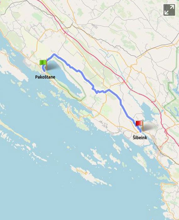
Pakoštane – Vrana (8 km) - Banjevci (19 km) - Zaton (42 km) - Šibenski most (44 km) - /grad Šibenik 52 km/ |
|
distance 44.00 km |
|
start Pakoštane |
|
end Šibenik |
|
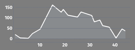
total climb 270.00 m |
|
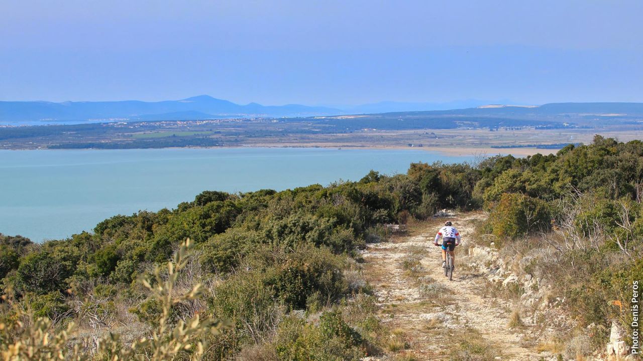
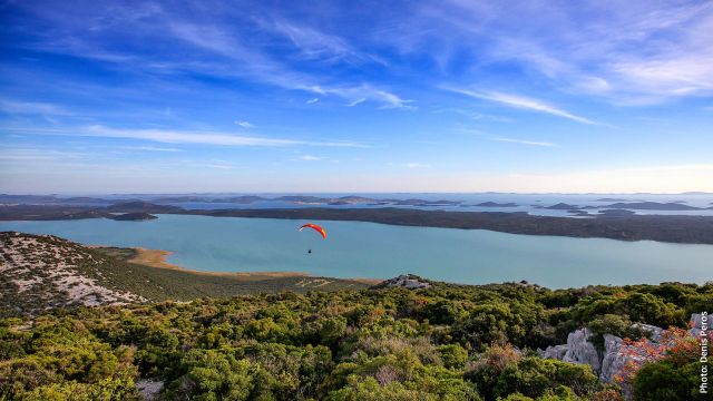
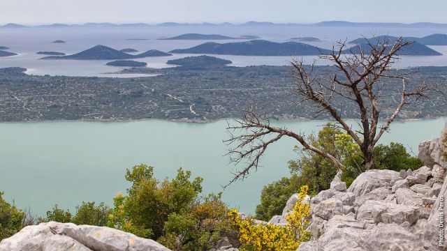
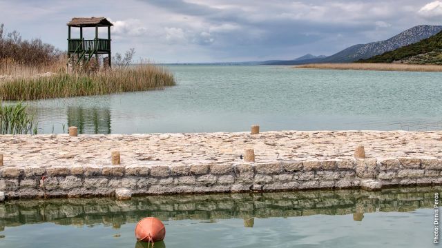
The route from Pakoštane along the campsite and the archaeological site of Crkvina near the Lake Vrana, the largest natural lake in Croatia, leads to the Dalmatian hinterland towards the village of Vrana. It passes by the ornithological station of the nature park and the bird observatory, next to one of the many reed beds along the road. A place located in Vrana that is definitely worth visiting is the Mašković Han – it is a complex built in the 17th century, which served as a lavish summer house of the Ottoman vizier Jusuf Mašković from Vrana, who was a high-ranking dignitary of the Sultan's court. The complex was renovated in 2015 and now houses a museum and a boutique hotel. Opposite the Mašković Han, you can see the ruins of the old town of Vrana, which was once a powerful medieval fortress where the Croatian royal crown was kept. From the road going through Radošinovci, you can turn right off the route to reach the Kamenjak Info Centre (a gently elevated road about 2.5 km long) and the lookout at Lake Vrana, from where you can see the Kornati National Park. The road will lead you along cultivated fields, gardens and olive orchards, before splitting right towards Banjevci and Pirovac, and soon afterwards leading into the village of Banjevci. The route continues towards Kašić through fields with cultivated vineyards and olive orchards. At the "Y" intersection after exiting the village of Kašić, you should turn left off the main road towards a narrower road to Putičanje. You should make two important turns, first a sharp one to the right and then another one to the left. The route passes through the village of Putičanje along old stone houses and leads to an exit to the left to connect to the main road once again. After passing through the business-industrial zone Novi Stankovci, the route connects to D27 to the right, and then continues on the road D27 straight towards Šibenik for about 10 km through fields. The route turns left off D27 and reaches Zaton and Raslina. From the square with a park in the centre of Zaton, the route passes along the parish church of St. George and turns to an idyllic road along the Zaton Bay and the marina, from where it begins to wind up towards the Šibenik Bridge, offering a fantastic view of the bay and the bridge. At the lookout – rest stop near the bridge and the hotel, the alternative section connects to the main DG13 section Pakoštane – Šibenik and continues over the bridge towards Šibenik for another 8 km.
|
|
Km |
Description |
|
Section length |
|
44 km (+ 6 km to the city of Šibenik) |
|
Asphalt/macadam ratio |
|
100/0% |
|
Total elevation: |
|
270 m |
|
Traffic density – moderate |
0
30 |
ŽC 6064 from Pakoštane to Vrana – 7 km D23 from Grabovci to the entrance to Zaton – 10 km |
|
Exercise caution on the intersection |
46 |
Passage over D8 by the Šibenik Bridge |
|
Supply options |
6 15 19 27
37 40 43 |
Vrana: store, coffee shop Radošinovci: coffee shop Banjevci: coffee shop, store Putičanje: Family farm – prior notification required Gaćelezi: restaurant Zaton: restaurant, store, coffee shop Bench with a view of the Šibenik Bay |
|
|
|
|
|
Rest options |
5 19
31
40 |
Vrana: museum, restaurant Banjevci: benches in the shade in the main square Grabovci: tables in the shade along road D27 Zaton: park next to the church |
|
Accommodation options |
|
only a few private apartments – check availability for an overnight stay |
|
Signposts
|
|
The alternative section of route A6 has no signs on EV8 The signposts on the main EV8 route (section DG13) includes points where the route splits from and connects to section A6 |
Section A6 is an alternative to DG13 Pakoštane – Šibenik. The main route will lead you along the coast, whereas the alternative section A6 will lead you through the Dalmatian hinterland. It has significantly less traffic and avoids macadam roads completely, but it also has significantly fewer accommodation and supply options. A6 splits from the DG13 daily section as soon as the route reaches Lake Vrana, and reconnects with it at the Šibenik Bridge at the 41st kilometre.
|
Km |
Technical description of the section |
|
0 |
Section A6 starts in Pakoštane at section 13 of the main route and continues on ŽC 6064 (bicycle signpost for Šibenik through Vrana). |
|
7 |
In Vrana, the road ŽC 6064 turns left after passing a store and the route continues straight ahead by following the signpost for Radošinovci. The route passes through Radošinovci, Banjevci and Kašić. |
|
24 |
1 km after exiting Kašić, the route splits off left to a side asphalt road at the Y-intersection. This road turns right at right angles after 700 m. After another 600 m you should turn left. This road will lead you through Putičanje and after 2 km you will exit on D59 and then continue left for 1.3 km towards the business-industrial zone of Novi Stankovci. |
|
28 |
D59 leads to D27, which continues rightwards towards Šibenik, through Grabovci and along Gaćelez. |
|
38 |
The route splits off left from D27 to Zaton and Raslina. |
|
40 |
From the centre of Zaton, the route exits to the right along the bay on the road ŽC 6088, by following the signpost for Šibenik, and after slowly going upwards along the Šibenik Bay for 4 km, it reaches D8 and the Šibenik Bridge, where it connects to the main route and turns left across the bridge to Šibenik. |

